Map shows impact of fire on Australian production
Australia
Sunday 26 January 2020
FJ
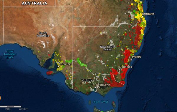
This new tool, Australian Bushfires Rapid Response Map, shows the extent of the damage caused by bush fires to the Australian fruit and vegetable industry.
Australian Bushfires Rapid Response Map is a map that is updated every 10 minutes. It shows the orchards of avocado, mango, olive, banana, macadamia and citrus that have been affected by the bush fires.
This map was produced in collaboration with universities, including the University of New England’s Applied Agricultural Remote Sensing Center (AARSC), federal and state government agencies, industry companies, and the Hort Innovation research foundation.

source : 9news.com.au


